

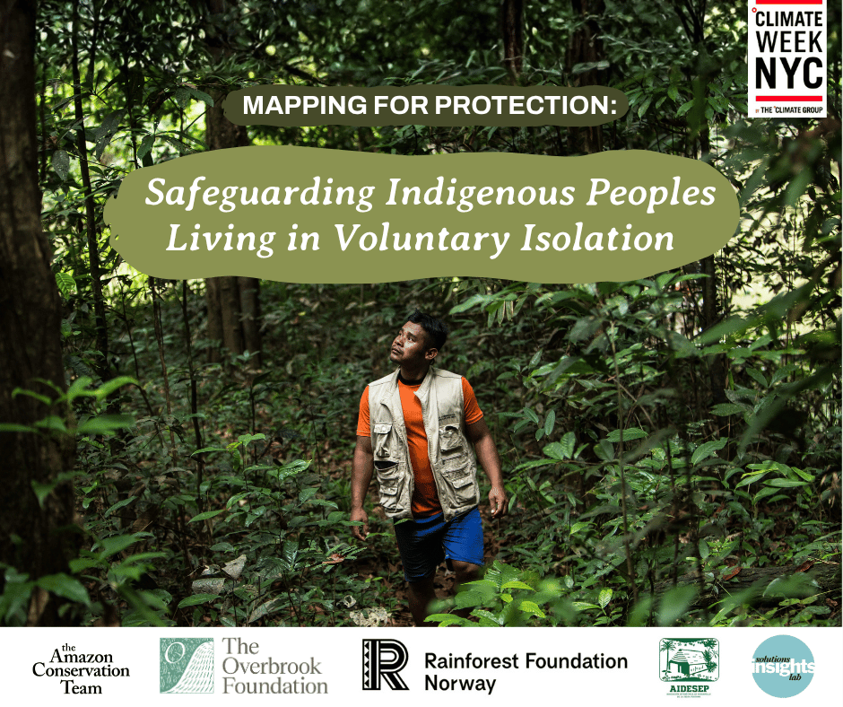
At Climate Week NYC, Indigenous leaders and conservation practitioners discussed how mapping and technology can help protect Indigenous Peoples Living in Voluntary Isolation while respecting their right to remain unseen.
Indigenous Peoples Living in Voluntary Isolation have chosen to maintain distance from wider society, often as a way of protecting their lives, cultures, and territories after generations of violence, exploitation, and forced contact.
Today, the territories where they live face increasing pressure from activities including illegal mining, logging, roads, and other forms of resource extraction.
Protecting these peoples requires a careful balance: how can their territories be protected without increasing the risks that come with visibility and contact?
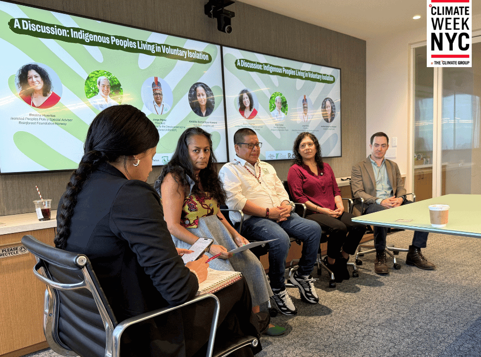
That question was at the center of Mapping for Protection: Safeguarding Indigenous Peoples Living in Voluntary Isolation, a Climate Week NYC conversation hosted by the Overbrook Foundation and the Amazon Conservation Team on September 23.
The panel brought together Jorge Pérez, President of AIDESEP; Beatriz Huertas, Isolated Peoples Policy Special Adviser with Rainforest Foundation Norway; Brian Hettler, Director of Mapping at the Amazon Conservation Team; and moderator Ambika Samarthya-Howard of Solutions Insights Lab.
Indigenous leadership is central to protection
The conversation began with the role of Indigenous organizations in protecting territories and the peoples living in voluntary isolation.
Jorge Pérez, a member of the Murui people from the Peru-Colombia border region of Loreto, described territory as much more than a physical space. It holds history, culture, ancestral knowledge, spirituality, and the relationships that sustain Indigenous life.
For generations, Indigenous organizations have worked to defend these territories. That work has increasingly included protecting Indigenous Peoples Living in Voluntary Isolation, whose territories often overlap with areas that remain among the most intact forests in the Amazon.
As Pérez explained, these communities have chosen to live in remote areas, in part to protect themselves from the violence and exploitation experienced by Indigenous peoples in the past. But as extractive activities move deeper into the forest, those territories are becoming increasingly difficult to protect.
Indigenous organizations are therefore not simply partners in territorial protection. They are leading many of the efforts to make that protection possible.
From Indigenous reserves to territorial corridors
Beatriz Huertas described more than four decades of work by Indigenous organizations in Peru to protect Indigenous Peoples Living in Voluntary Isolation.
One important approach has been securing official recognition of Indigenous reserves. But Indigenous organizations and their allies have also been developing a broader concept: territorial corridors.
Rather than viewing territories through isolated legal categories, territorial corridors seek to protect the larger, continuous territories inhabited by Indigenous Peoples Living in Voluntary Isolation, including across national borders.
These landscapes can encompass enormous areas of forest and the territories of multiple Indigenous peoples, including communities that are actively organized and often play an important role in protecting neighboring peoples living in voluntary isolation.
The scale of this work also highlights the importance of resources reaching the organizations leading it. Huertas noted that, despite the growth of climate finance, only a small share reaches Indigenous organizations directly.
For territorial protection to be effective, Indigenous organizations need not only recognition of their rights, but also the resources and capacity to carry out their own strategies.
Using technology without increasing contact
Mapping plays a particular role in this work because conventional approaches can create risks.
As Brian Hettler explained, ACT uses remote sensing and satellite imagery to study territories without sending researchers or field teams into areas where contact could endanger Indigenous Peoples Living in Voluntary Isolation.
One of the first challenges is establishing evidence that these communities exist.
In some cases, neighboring Indigenous communities have knowledge of peoples living in voluntary isolation, but that testimony alone may not be accepted by governments when determining whether an area should receive legal protection.
Remote sensing can provide another form of evidence.
ACT has developed non-invasive approaches that use satellite imagery to identify signs of settlements across vast areas of forest, supporting anthropological studies and efforts to establish or strengthen territorial protections, including protections for Indigenous territories and national parks.
Remote sensing also helps researchers understand the environmental importance of the territories of isolated Indigenous peoples without entering those areas and risking potential contact situations. Remote analysis indicates that many isolated groups inhabit some of the most intact forests in South America, including areas with high levels of carbon sequestration whose protection is essential to prevent a worsening of the global climate crisis.
The same technologies can also help monitor threats such as illegal logging and mining activity in remote areas that are difficult to monitor through patrols alone. The resulting information can then be shared with relevant networks to inform and support action.
Protecting people without making them more visible
One of the central challenges discussed during the panel was the tension between visibility and protection.
For many conservation and human rights efforts, greater visibility can help bring attention and resources to an issue. For Indigenous Peoples Living in Voluntary Isolation, however, increased visibility can create additional risks.
As Ambika Samarthya-Howard noted during the conversation, the challenge is not simply that these peoples are isolated. It is that becoming more visible can make their territories easier to encroach upon while potentially increasing the risk of unwanted contact.
This makes non-invasive mapping particularly important.
The goal is not to make these communities more visible to the public. It is to generate enough information to help protect their territories while safeguarding their right to remain in voluntary isolation.
When mapping becomes territorial action
The panel discussed the importance of connecting geographic information to Indigenous-led monitoring systems and, when necessary, government action.
In Peru, Indigenous organizations have established territorial planning and monitoring centers where information gathered by community monitors can be combined with satellite imagery and other technologies.
Young Indigenous people are increasingly involved in this work, learning to interpret satellite information and identify signs of deforestation or other threats.
Jorge Pérez described this as an important shift: technology does not remain in the hands of outside specialists. It becomes part of the community’s own capacity to monitor and protect its territory.
When a threat is identified, the information can serve as evidence to engage government authorities. In this regard, the panel emphasized that communities cannot be expected to confront armed actors or illegal activities directly. Some situations require a response by law enforcement and other government institutions.
This distinction is critical: technology can help communities identify and document threats, but territorial protection also depends on institutions being willing and able to act.
Data protection is part of territorial protection
The conversation also raised another important question: who controls the information generated through mapping?
For sensitive territories, data sovereignty is not an abstract technical issue. Geographic information can reveal locations, cultural information, environmental resources, or other details that could be misused.
For this reason, ACT’s approach emphasizes keeping information accessible to communities and avoiding systems in which sensitive data is automatically stored or shared outside their control.
Brian Hettler described efforts to develop locally managed technological solutions, including systems that allow communities to access cultural maps and oral histories through local networks. He emphasized that technology itself will continue to change, making general community capacity more important than facility in any one platform.
Technology can also create connections between generations, allowing younger people to develop digital skills while working with elders to document and transmit traditional knowledge.
Protecting territories is also protecting forests
The protection of Indigenous Peoples Living in Voluntary Isolation is fundamentally a human rights issue. It is also closely connected to conservation.
Because these communities depend on intact forests and have maintained distance from activities that cause widespread environmental degradation, their territories often overlap with some of the Amazon’s most intact and ecologically important areas.
ACT’s remote-sensing work has found that territories associated with Indigenous Peoples Living in Voluntary Isolation include areas with high biodiversity, important headwaters, and significant carbon stocks.
Protecting these territories therefore has broader implications for the forests and ecosystems that surround them.
But conservation cannot come at the expense of the people whose rights are being protected. The panel repeatedly returned to the importance of Indigenous leadership and approaches that prioritize the safety, autonomy, and decisions of Indigenous peoples.
From the Amazon to other regions
The approaches being developed in the Amazon may also offer lessons for other regions where Indigenous Peoples Living in Voluntary Isolation or similar communities face growing pressures.
During the discussion, participants highlighted emerging exchanges with Indigenous organizations in other tropical forest regions, including Indonesia. ACT has decades of experience bringing together Indigenous organizations, civil society, technology, and governments around territorial protection, experience that can inform conversations elsewhere.
Scaling these approaches does not mean simply exporting a technological model. The central lesson is the importance of building systems around Indigenous leadership, local knowledge, community capacity, responsible data practices, and the specific realities of each territory.
Mapping for protection, not exposure
The Climate Week conversation made clear that mapping can play a powerful role in protecting Indigenous Peoples Living in Voluntary Isolation, but only when the technology is used carefully and with a clear understanding of what protection means.
For ACT, that means using mapping and remote sensing to help document territories, identify threats, support territorial rights, and strengthen Indigenous-led monitoring, while avoiding approaches that could increase the risk of contact.
Ultimately, the map is not the objective. The objective is protection: of people, territories, forests, and the right of Indigenous Peoples Living in Voluntary Isolation to determine their own future and remain in voluntary isolation.
Want to learn more about Indigenous Peoples Living in Voluntary Isolation in the Amazon Rainforest and Gran Chaco?
Explore our award-winning StoryMap, A Fight for Survival, to learn more about their territories, the pressures they face, and the urgent need to protect their rights, lands, and autonomy.
Share this post
Bring awareness to our projects and mission by sharing this post with your friends.