

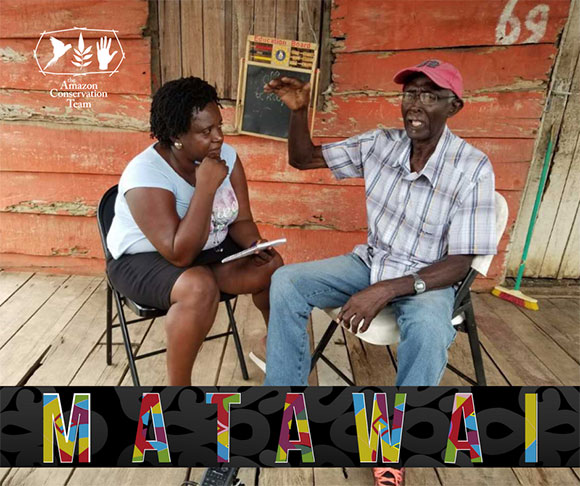
Along the Saramacca River in central Suriname live the Matawai people. They are descendants of Africans who escaped slavery in the 17th and 18th centuries by fleeing into the jungles and fighting for their freedom.
In the rainforest, the survival of the Matawai has always depended on an intimate knowledge of their territories. Place-based stories can help a people remember where food or resources can be found, or where dangers lie hidden. More importantly for the Matawai, the stories reinforce their cultural and spiritual connection to their territory, which makes them want to safeguard it. But the stories are in danger of dying out as many younger Matawai leave their forest homes to work in the city or in gold mines.
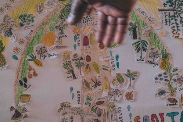
Since our inception, we have worked with communities to reconnect the threads that join one generation to another, so that the process of knowledge transmission can continue. In the course of collaboratively mapping the Saramacca River in the past few years, we discovered that the Matawai elders have stories connected with hundreds of locations throughout their territory. When plotted on a map, the stories create a multi-dimensional representation of the Matawai experience, past and present.
We have created an interactive, multimedia map-based portal that connects locations to the important stories that enrich the map with cultural and historical information, and preserve these vital stories for generations to come.
To do achieve this, we teamed up with a local Matawai community organization Stichting voor Dorpsontwikkeling Matawai to train young Matawai to record the stories of their elders on video. And, together with our technology partner Mapbox and a team of volunteer developers from Ruby for Good, we developed a customized geo-storytelling application called Terrastories (terrastories.io).
Terrastories brings the latest in digital mapping technology offline by installing and running Mapbox tools on local computers in Matawai villages, so that the Matawai can experience the full capabilities of interactive maps without needing internet connectivity.
Once piloted with the Matawai, Terratories will be released as open-source software so that other communities and organizations around the world can adapt it to map their own place-based storytelling traditions.
By using our overlapping strategies of Land, Livelihoods, and Governance, together we are protecting and strengthening the Saramacca River, its surrounding lands, and its guardians.
Share this post
Bring awareness to our projects and mission by sharing this post with your friends.