The great wealth of biodiversity present in the Amazon is at serious risk of disappearing due to several threats, which must be addressed through the joint work of the various stakeholders in the region. One of the first steps in addressing this problem is to identify which species of flora and fauna are present in a given area. Biodiversity inventories reveal population changes over the medium and long term, enabling the planning and development of management studies and negotiations over natural resources that ensure the conservation of biodiversity.
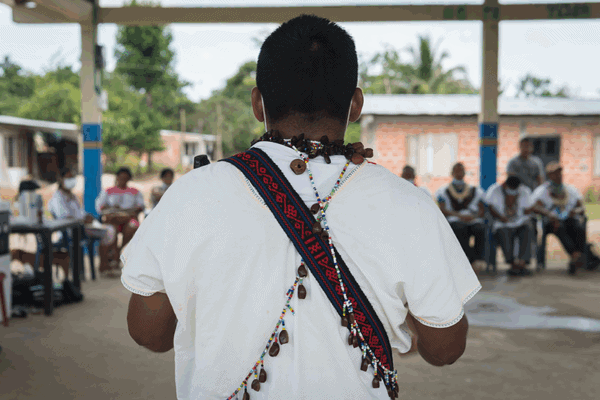
For these efforts to be carried out optimally, it is essential to consider the ancestral knowledge that indigenous populations possess regarding their territories and the management of fauna and flora, and together with them facilitate dialogue and collaboration with the scientific community.
In this respect, ACT has carried out various activities in its field of work, taking into account the reality and needs of the indigenous (local) communities as well as efforts of the government agencies, research institutes, universities and civil society in the region. Our objective is to unite efforts around the difficult task of conserving and managing biodiversity and ecosystem services in the Amazon.
Fragua / Churumbelos / Cueva de los Guacharos Corridor
Alto Fragua Indi Wasi
In the region of the Alto Fragua Indi Wasi and Cueva de los Guacharos national parks and their buffer zones, ACT has been conducting floristic surveys together with the Laboratory for Tropical Forest Ecology and Primatology of the Universidad de Los Andes. Around 46 plots of 2.5 acres (0.1 hectares) have been surveyed. The activities have been developed in consensus with the small farmer communities of the region. The results will be shared with the communities and local governments and will help fill information gaps about the region.
Working together with the university has not only helped to increase knowledge of the plant biodiversity of the region: it also has involved undergraduate students and recent graduates in activities, giving them a real understanding of the region and its problems, and in this way has begun to develop professionals with a greater capacity to provide relevant solutions for problems facing the region.
Indigenous Communities of the Middle Caquetá River Region
ACT is assisting the communities of this region in capturing detailed knowledge of biodiversity in their territories, supporting community monitoring actions through camera-trapping, control and surveillance expeditions, and biological protection and conservation programs. These activities have made it possible to fill an important information gap in this region of the Colombian Amazon. The analysis of the information generated showed that this region is megadiverse, with poor soils but abundant wildlife, and with a continuous canopy and healthy aquatic ecosystems that continue to serve as biological corridors.
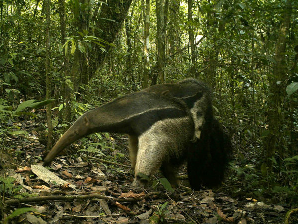
ACT camera trap image of giant anteater
Here, the team recorded more than 200 birds, 30 amphibians, 20 reptiles, and 44 medium-sized and large mammals, all identified by the indigenous communities. Here, we noted significant identifications of endangered species in Latin America. These include the giant otter, the jaguar, the puma, the giant armadillo, tapirs, monkeys and endemic species that are conserved in the territory of the indigenous communities.
Supporting communities in biological recognition processes is useful for territorial empowerment, serving as a baseline for decision-making and identification of threats and strategies. It also contributes to the environmental management planning of the reserves, helping to ensure the maintenance of traditional culture and territory for future generations and supporting sustainable use of the forest.
Río Puré National Park
In the lower Caquetá River region, ACT has supported the updating of the management plan, the design of the monitoring program, and the preparation of the research portfolio for the 2,470,757-acre (999,880-hectare) Rio Puré National Park.
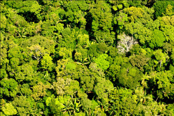
Río Puré National Park
Despite the biological studies carried out in the protected area, the gathering of knowledge regarding its diversity and richness of flora and fauna species is still incipient. Since 2016, ACT has been holding trainings for the park team including the study of bird communities, sampling methodologies, and species identification.
To date, the assembled list of bird species contains 275 species, and the park team continues to carry out field samplings. Additionally, the inter-institutional coordination team (consisting of the Colombia National Parks Unit, Conservation International, and ACT) has enabled the assembly of 60 camera traps in an area of approximately 21,498 acres (8,700 hectares), for the development of a baseline on the composition of medium-sized and large vertebrates in the Puerto Franco sector (Río Puré National Park) between March and June 2018.
At present, the information is being consolidated, and 27 species of terrestrial vertebrates have been recorded. Additionally, eight indigenous officials of the park participated in a training session for the programming, input, downloading and storage of the information.
The results obtained will serve as the basis for the strengthening of the monitoring information system of the National Parks System of Colombia and for ascertaining the status of the populations within the protected area.
Curare – Los Ingleses Indigenous Reserve
Since 2013, with the support of ACT, a program for biodiversity conservation and protection of the territory of isolated indigenous peoples has been strengthened through the renovation and supplying of the Puerto Caimán control post, which is located in the conservation area of the reserve. Subsequently, a cooperation agreement was signed to strengthen the programs that support the reserve’s self-determination with respect to territorial governance, autonomy and sustainable management. Among the strengthening programs are GPS and cartography, data entry, and computer use training, all enabling the indigenous communities to build their ability to make sound decisions regarding the management of natural resources in their territory.
Serrania de Chiribiquete National Park
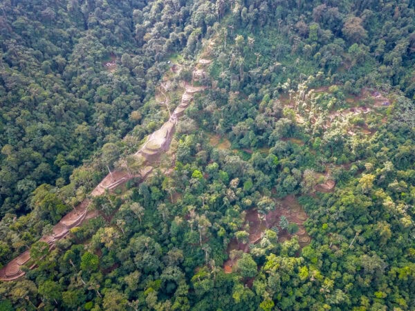
ACT carried out studies that contributed to the development of a document presented to the Colombian Academy of Sciences to support the second expansion of the Serrania de Chiribiquete National Park. These revealed that 17 types of vegetation cover exist (Quiñones et al., 2017) in the park’s 3,673,656 acres (1,486,676 hectares).
Additionally, the expansion of the park benefits the continuance of many species of plants (708), birds (410), fish (216), amphibians (53), reptiles (41), butterflies (293), and arachnids (78), among others.
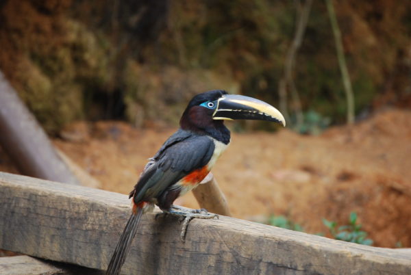
Chestnut-eared aracari
The types of vegetation in the park’s area of expansion would enable the isolated indigenous peoples the use of areas such as high, medium and low forests, savannas, and grasslands; areas of tree coverage such as cananguchales (places of great importance for food gathering from the species Mauritia flexuosa canangucho, as well as the hunt for tapirs), and consociations of Jessenia sp. and Euterpe sp., respectively (of importance both for human consumption and the provision of materials for the construction of habitations); dense or sparse várzea forests over white sand deposits, places traditionally of relative importance for the procurement of medicinal plants and materials for hunting implements (blowguns and arrows); and floodplain forests, of great interest for fishing during the rainy season.
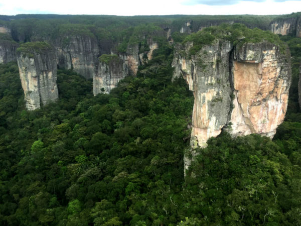
Chiribiquete National Park
The conservation of these forests permits the stable functioning of natural systems, ecosystemic connectivity between the Andean, Orinoquian and Amazonian provinces, the flow of genetic and biological diversity, and the dispersion of seeds, among other essential relationships.
Share this post
Bring awareness to our projects and mission by sharing this post with your friends.


