

At Climate Week NYC, Amazon Conservation Team, Esri, Humanitarian OpenStreetMap Team, and Solutions Insights Lab explored how community-generated data can support conservation, territorial rights, disaster response, and local decision-making.
Maps can show where a forest stands, where a river runs, or where a community’s territory begins. Participatory mapping can do even more: it can help communities document their knowledge, strengthen territorial claims, plan how their lands are managed, and make decisions based on information they have helped create and control.
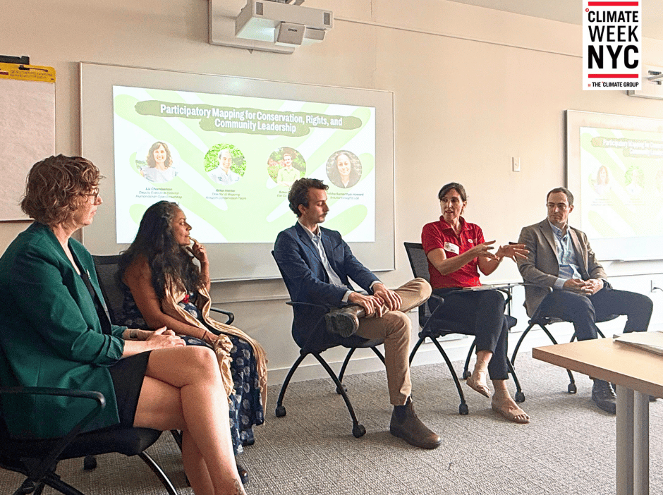
That was the focus of “Participatory Mapping for Conservation, Rights, and Community Leadership,” a Climate Week NYC panel hosted by Esri and ACT on September 24. The conversation brought together perspectives from conservation, humanitarian mapping, geospatial technology, and solutions journalism, with Brian Hettler, Director of Mapping at the Amazon Conservation Team; Liz Chamberlain of the Humanitarian OpenStreetMap Team; Simon Jolly and Sunny Fleming of Esri; and moderator Ambika Samarthya-Howard of Solutions Insights Lab.
Throughout the discussion, one perception kept coming back: the map is only the beginning.
Putting communities at the center of the map
The conversation began with a fundamental question about who creates geographic information and who gets to decide how it is used.
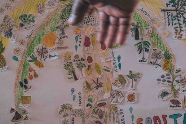
For ACT, participatory mapping starts with the communities themselves. Rather than arriving with predetermined objectives, ACT works with communities to identify what they want to map, who will lead the process, and how the resulting information can support their priorities.
As Brian Hettler explained, the process can help communities identify places that are important for food, culture, biodiversity, and governance. It can also create space for different generations to exchange knowledge: elders share knowledge about places and practices, while younger people increasingly use digital tools to document and preserve it.
ACT has been using participatory mapping for nearly three decades, with practices evolving from hand-drawn community maps to approaches that combine satellite imagery, mobile data-collection tools, audiovisual storytelling, and geospatial technology.
The technology may change, but the principle remains the same: the knowledge and capacity should stay with the communities who live in the territories.
From local knowledge to territorial action
One of the most powerful examples discussed was ACT’s work with Indigenous communities in Colombia’s Andes-Amazon region.
Communities have used participatory mapping to document biodiversity, cultural sites, and traditional uses of their territories. That information can then inform management plans, including identifying areas for conservation, restoration, and ecological connectivity.
Mapping can also strengthen territorial rights. Documenting Indigenous place names, traditional land use, and knowledge of a territory can provide important information for communities pursuing land rights or the recognition and expansion of Indigenous reserves.
For ACT, this is where mapping moves beyond documentation and becomes a tool for action.
The organization has partnered with more than 400 Indigenous and local communities and supported the establishment and expansion of Indigenous territories in Colombia. Its mapping work has also contributed to the recognition of Indigenous place names within Colombia’s geographic databases.
More data doesn’t always mean better data
Liz Chamberlain brought another perspective to the discussion through the Humanitarian OpenStreetMap Team’s (HOT’s) work.
HOT combines community knowledge, open data, satellite and drone imagery, field mapping, and increasingly AI-assisted tools to create geographic information that can be used by communities, governments, and humanitarian organizations.
HOT starts by understanding what information a community or organization actually needs. From there, teams can determine what data needs to be collected and whether mapping is the appropriate tool.
That distinction matters at a time when increasingly sophisticated technologies are producing enormous amounts of data. The panel emphasized that larger datasets do not necessarily mean better information. Local knowledge can provide information that satellite imagery and large-scale datasets cannot capture.
In humanitarian contexts, this can be critical. After disasters, volunteers can use open mapping platforms to identify buildings, infrastructure, clinics, roads, and other features, helping responders understand changing conditions on the ground. But the same principles can also support longer-term conservation, resilience, and community planning.
Liz Chamberlain shared an interactive demonstration of MapSwipe, an application developed by HOT and the Missing Maps Project in which volunteers can actively contribute to geospatial data projects. Using an easy-to-use interface, volunteers can help identify infrastructure, track environmental changes, and validate map data.
The map is not the end product
For Ambika Samarthya-Howard, one of the most important insights from the discussion was the idea that mapping is a means to evidence and advocacy.
A map can make information visible. But its impact comes from what communities and organizations can do with that information.
For ACT, this can mean using maps to support land rights, develop territorial management plans, monitor environmental change, or help communities understand what is happening across their territories.
Sometimes, simply seeing a territory from a different perspective can change how people understand it. Satellite imagery can reveal patterns of deforestation or fragmentation that may not be visible from the ground. Bringing that information back to communities can help inform their own priorities and decisions.
As Brian Hettler emphasized during the conversation, the goal is not for an outside organization to determine what a community should map. The process begins with communities defining their own priorities and building the capacity to manage and use the information themselves.
Whose data is it?
With greater access to mapping technology comes a critical question: who owns the information?
The panel discussed how data collected through community mapping can become disconnected from the people who contributed to it. When outside organizations retain control of community-generated data, communities may not be able to access, update, or share information about their own territories.
For ACT, community control is therefore part of the mapping process itself.
This becomes especially important when maps contain sensitive cultural or ecological information. Some information may be appropriate for public maps, while other information should remain within the community.
The panel also discussed how cartography can help manage this tension. Information can sometimes be generalized or presented at a less detailed scale so that important patterns are visible without exposing sensitive locations.
For Indigenous territories, sacred sites, and particularly territories inhabited by Indigenous Peoples Living in Voluntary Isolation, what is left off a map can be just as important as what is included.
Building capacity that lasts
Technology platforms will continue to change. Satellite imagery will become more detailed. AI-assisted mapping will continue to evolve. New data collection tools will emerge.
But the panelists returned repeatedly to the importance of building knowledge and technical capacity within communities.
For ACT, that means supporting Indigenous organizations not only with mapping technology, but also with the organizational and governance capacities needed to maintain and use that knowledge over time.
Technology can also create connections between generations. Younger community members may be interested in digital tools, while elders hold deep knowledge of places, histories, and cultural practices. Participatory mapping can bring those forms of knowledge together, using technology as a tool for transmitting traditional knowledge rather than replacing it.
Connecting efforts instead of duplicating them
The discussion also highlighted an opportunity for mapping to connect organizations working across the same landscapes.
Conservation organizations, Indigenous organizations, humanitarian groups, researchers, and other actors may be working in overlapping areas without always knowing what others are doing. Mapping areas of interest, activities, and existing data can help identify opportunities for collaboration and reduce unnecessary duplication of data collection.
This is particularly relevant in a sector where funding and capacity are limited.
Open data platforms can make some information more accessible across organizations, while community ownership and data sovereignty remain essential considerations for information that should not be publicly shared.
Preparing for what comes next
The conversation ultimately expanded beyond conservation and humanitarian response.
Participants discussed how participatory mapping can support climate adaptation and disaster preparedness, helping communities document risks and vulnerabilities.
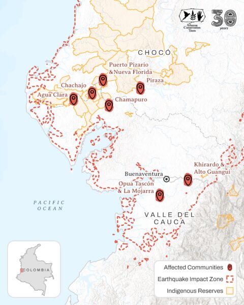
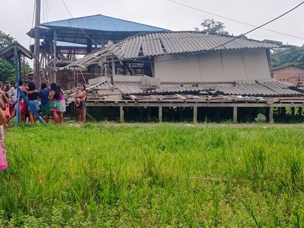
ACT is already seeing this need in territories affected by flooding, fires, environmental degradation, and threats to community leaders. Mapping can help communities understand these pressures and plan responses before they become emergencies.
The conversation also raised questions about the future of AI and geospatial technology. While AI can help accelerate certain mapping tasks, the panel emphasized the continuing need for human validation and local knowledge. Technology can make mapping faster; it cannot replace the people who understand what the data means.
Mapping with communities, not just about them
Participatory mapping is ultimately about more than producing better maps. It is about who has the knowledge, who controls the data, and who gets to use it to make decisions.
Across ACT’s work, maps have helped Indigenous and local communities document their territories, strengthen land rights, develop conservation plans, monitor change, and preserve knowledge across generations. At Climate Week NYC, the discussion with Esri and Humanitarian OpenStreetMap Team highlighted how these approaches can also connect conservation with humanitarian response, climate resilience, technology, and advocacy.
Technology will continue to evolve. But the most important part of the process remains the same: putting communities at the center of the information about their own territories and ensuring that the capacity to use that information stays with them.
Share this post
Bring awareness to our projects and mission by sharing this post with your friends.