

Mapping threats in the Amazon
Maps imply some form of permanence and recognition. If something has been “put on the map”, it means that it will get noticed, and be there for years to come. For the Amazon Conservation Team’s (ACT’s) conservation work in the Amazon and along coastlines, getting places in the official geographic record is important to protect both ecosystems and cultures. We work with communities to map their traditional territories, so that those areas can become legally protected and governed by the communities that have cared for those forests for generations. But maps and mapping technology can also reveal unwelcome changes. Deforestation, illegal mining, logging, and drug trafficking routes all become visible when we have a bird’s eye view of the Amazon, especially over time. Understanding these threats to the rainforest, Indigenous peoples, and our planet, allows us to take positive action towards protection.
Illegal mining leaves a trail of contamination
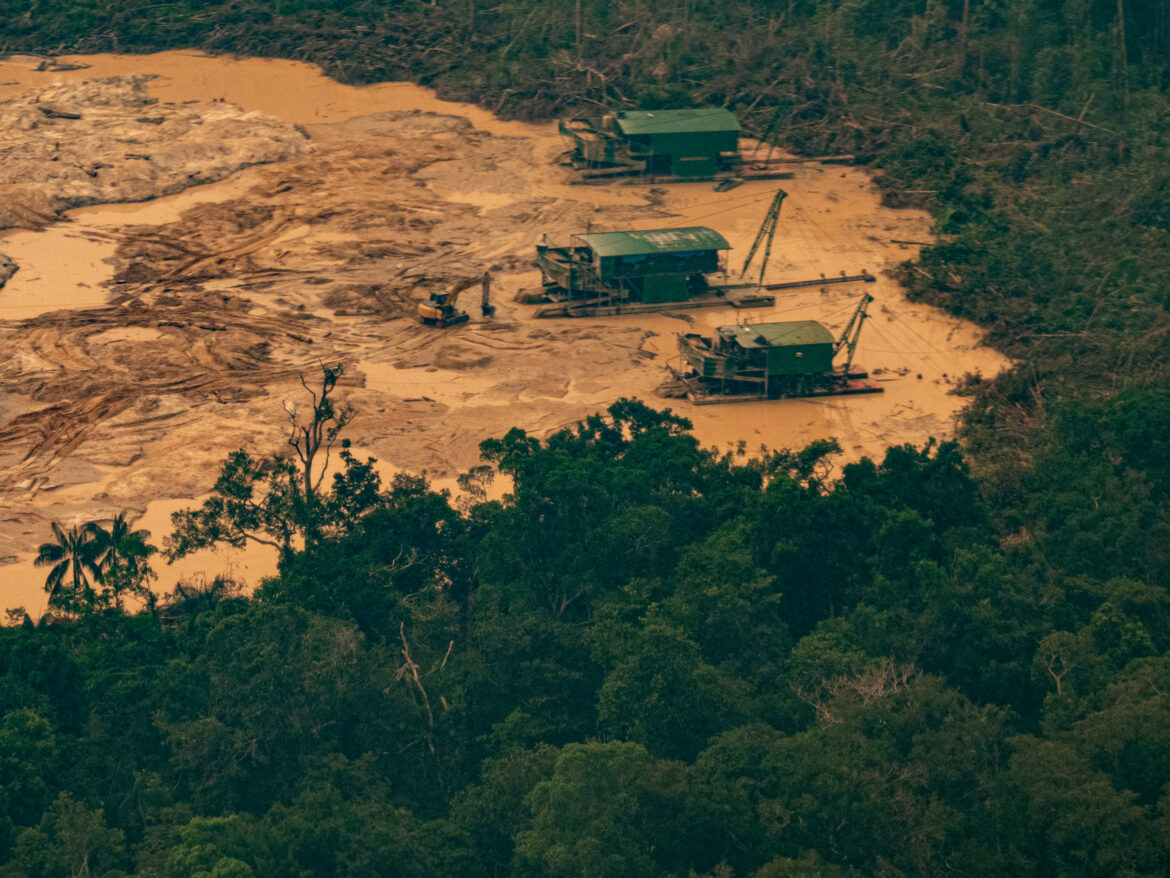
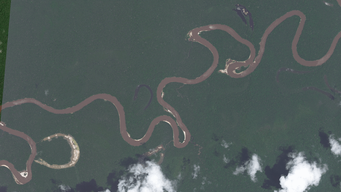
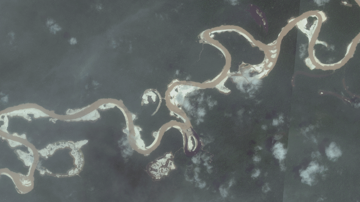
One of the major threats to both communities and ecosystems is illegal mining, which has risen sharply in recent decades. ACT has observed more than 900 illegal mining barges using remote satellite imagery. These large floating dredges along the banks of Amazonian tributaries are usually in search of gold, leaving a visible trail of environmental destruction. “We physically can’t go in, so mapping allows us to see threats over time,” said Pascual González, who supports ACT’s participative mapping and data analysis.
In a sea of green, satellite images reveal what look like growing sandy bald patches from mining settlements The banks of rivers are bulldozed, including trees and rock, and water is vacuumed into dredges where it is mixed with mercury to extract gold. The mercury is then released back into the water. This not only disturbs habitats but also creates deadly public health risks for Indigenous and local communities who drink the water and eat mercury contaminated fish.
More than 2.3 million people have been exposed to mercury from illegal mining, according to a report from CMIA, a coalition of organizations against illegal mining of which ACT is a member. The same report found that illegal mining in Amazonia has destroyed more than 5.5 million hectares of forest and released more than 330 million tons of CO2.
Spotting and mapping these illegal mines near communities allows ACT to alert the local enforcement agencies of their presence, resulting in the destruction of nearly 100 illegal barges.
Illegal logging goes unchecked
Much like illegal mining, logging across the Amazon is increasing and leaving a visible trail of ecological damage. This is particularly true in Peru, says Adam Bauer -Goulden, who coordinates with Indigenous groups there for ACT. “There’s pretty much no state presence in these areas, and logging networks have taken advantage,” Bauer-Goulden says.
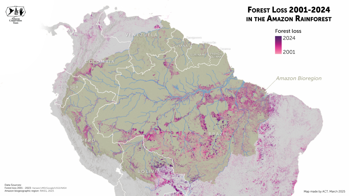
The problem has grown since the COVID-19 pandemic. According to a report by the Brazilian NGO Imaflora, between August of 2022 and July of 2023, illegal forest clearing surged by 19 percent. During that time, 350 football fields worth of timber were illegally cleared each day across the Amazon.
Deforestation alert mapping allows ACT to see in real time where change is happening. “When we identify illegal logging, we’ll present a legal briefing introducing that evidence into the case. We’re finding that they’re continuing logging in some Indigenous intangible zones,” Bauer-Goulden says.
Indigenous peoples living in isolation
Intangible zones are home to Indigenous peoples in isolation, groups who have chosen to live deep in remote regions of the Amazon and who have no regular contact with non-Indigenous people. These zones are often enormously biodiverse and ecologically rich. Tourism, industry, and other commercial activities are prohibited to protect these intact forests and the communities who rely on the forest for their survival.
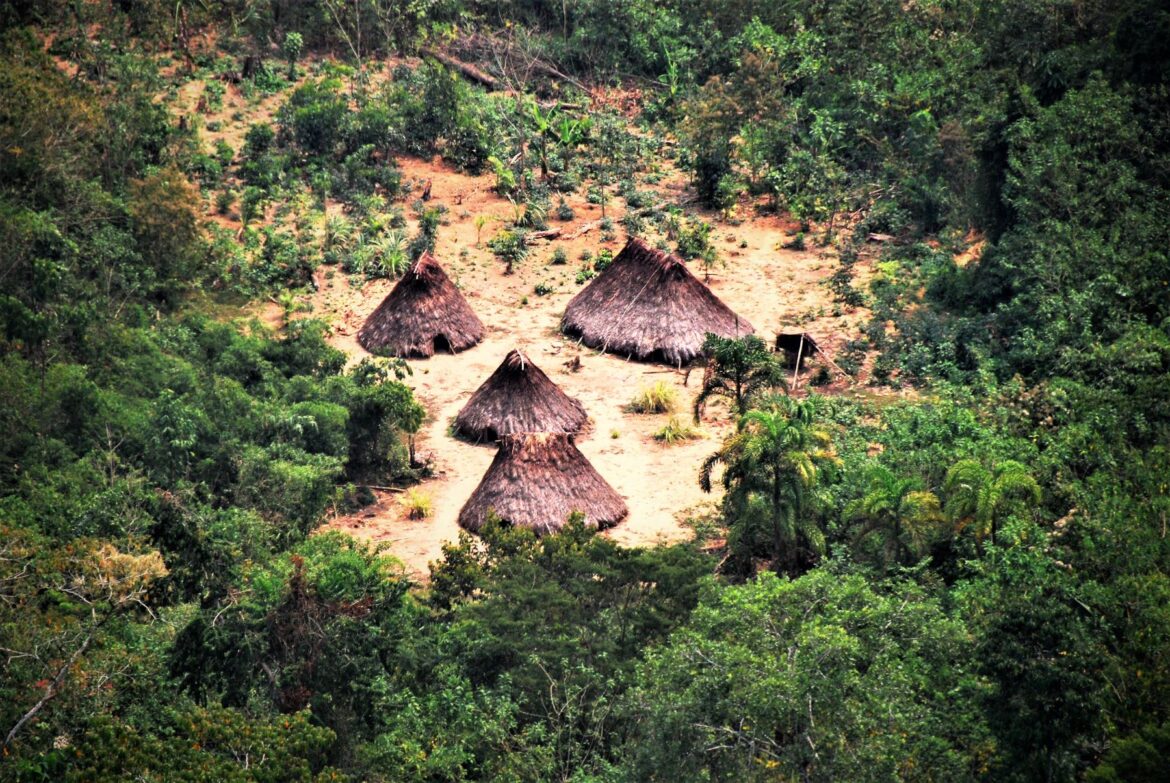
Part of Bauer-Goulden’s role with ACT is coordinating with Indigenous communities in Peru to gather testimonies that determine where these neighboring peoples in isolation are located. Testimonies are combined with satellite mapping imagery that offers evidence of their presence — malocas (communal structures), small gardens, or footpaths — point to isolated groups. 128 of these groups across the Amazon basin are officially recognized by Indigenous and civil society organizations, but only 60 have been legally recognized by states. For Indigenous peoples in isolation to be protected from outside threats – whether extractive industries, diseases, or missionaries – their traditional territories must be identified. And ACT’s mapping team helps to do that.
Bauer-Goulden says that increasingly in Peru, they are seeing logging in forests adjacent to isolated Indigenous groups. In one satellite image, he saw a logging road heading directly towards malocas in the forest. A year later, those homes were abandoned. “They’re not reconstructing them because their territories have been under siege,” says Bauer-Goulden.
ACT’s mapping work helps to document and mitigate these threats. While they may be increasing across the Amazon, there are also stories of hope and solutions. “Each section of the Amazon has a different dynamic, and mapping helps us find more tailored solutions to each region,” says Pascual Gonzalez.
Whether by giving communities the tools to document and protect their sacred sites along the Colombian coast, or by helping to prevent illegal mining barges from contaminating communities, ACT is mapping a better future for the Amazon and beyond.
Share this post
Bring awareness to our projects and mission by sharing this post with your friends.